|
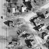
Photogrammetric
mapping, commonly referred to as aerial mapping, is the science of measuring distances and elevations from aerial photography.
Minuteman Mapping utilizes existing aerial photos from a number of sources throughout the northeast,
as well as obtaining new photo coverage during the spring and fall flying season.
|