|
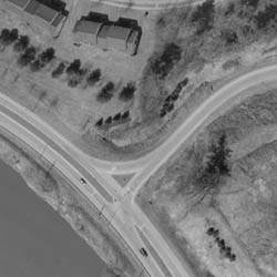
Another very useful aerial product is Digital Orthophotography.
Minuteman Mapping delivers orthophotos in either color or black and white formats, providing
a pictorial backdrop to the line work of a vector map. Orthophotos provide spatial data for the project area which is not
limited to vector information. This information is ideal for municipal GIS use because of the added ability to visualize land
use, an important consideration for property evaluation; environmental remedial plans; and transportation route designs.
|